Create a Spunch Type Course
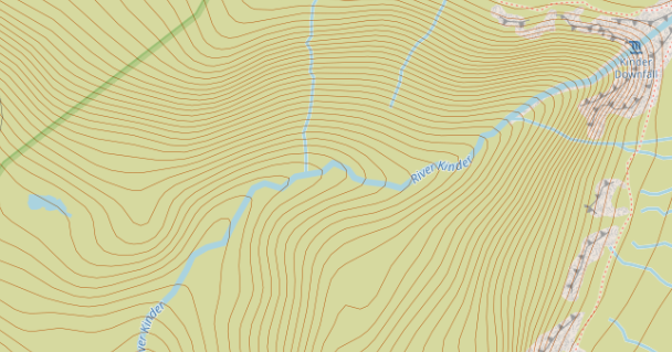
Pennine put together a Spunch type event that proved very popular. Speaking to the creator afterwards I learned the most difficult thing was correctly identifying the checkpoint positions. Below shows the difficulty. Say you want to put a checkpoint by the little island in the river south of the "S" of Mermaid's Pool below Kinder Downfall.
Above are the instructions that we were provided with to enable us to produce a course - The section requiring the use of Google Earth to precisely fix the checkpoints is not easy.
My profession is in software development. Back during the first lockdown I had a go at writing an Android MapRun type of app using Java. I did not get very far on it but I got the basics of establishing my position going. From a OS map it is very easy to get the Eastings and Northings for the desired position, you just need to convert that into Longitude and Latitude. There are rather scary maths involved but it is possible to convert between the two systems. After chatting about the issues highlighted above I did a bit of Googling and it turns out it is actually very easy to get a Longitude and Latitude from a OS map using Bing maps.
Below I am just expanding the instructions in the attached PDF and adding my own alternative for getting accurate CP locations.
1) https://oomap.co.uk/ then click on Version 4
2) Select PseudO

3) Click A4 and 40K
This is now the area that will be printed on an A4 sheet.


The first checkpoint must be the start and then progress though all the CPs until selecting finish as the last one. Ensure that the finish position is selected so that the competitors do not accidently pass through it while waiting to start or while out on the course. Use whatever features are available on the map to correctly position your checkpoint. If that is not possible just position it vaguely in the correct position.
5) Once you have selected all the CPS then progressively start to click down through these map sizes to get the smallest one that will contain all of your CPS. The blue dot can be used to move the map frame around.

6) Click on KML to download the list of checkpoints.

If desired click on the PDF map button to download the graphic of the course.
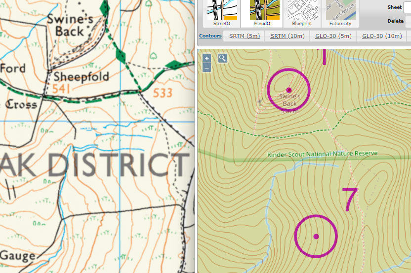
7) Now we need to fix any suspect checkpoints
Checkpoint 7 is intended to be at the wall corner directly south of the "D" of District. But it was pure guess work when positioning it.
Use a text editor to edit the "kml" file that was downloaded. The simple notepad that is in Windows would do; but a much nicer one is Notepad++ which can be downloaded for free from here. Notepad++
The KML file will look something like below.
In my case I want to fix the highlighted number for CP7
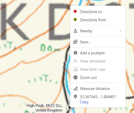
 It is as simple as go to Bing Maps zoom into the area and switch to OS view

Zoom right in to just before the OS view disappears and right click on your desired CP to view its longitude/latitude at the bottom of the popup.
 Now you just need to replace the longitude/latitude values in the KMZ file with those you got from Bing. Be careful you do not loose the zero at the end.
Zoom right in to just before the OS view disappears and right click on your desired CP to view its longitude/latitude at the bottom of the popup.
The Bing values are less accurate. However with six decimal places they still go to 1/1,000,000 of a degree, which is still more than accurate enough for a Spunch event. What would be nice is the ability to re-upload the KMZ file to the website so that your CPs will be "fixed" on that as well but it is not possible.
The chart below provides more details on the level of accuracy provided based on the number of decimal places in the coordinates:
| Decimal Places | Degrees | Distance |
| 0 | 1.0 | 111 km |
| 1 | 0.1 | 11.1 km |
| 2 | 0.01 | 1.11 km |
| 3 | 0.001 | 111 m |
| 4 | 0.0001 | 11.1 m |
| 5 | 0.00001 | 1.11 m |
| 6 | 0.000001 | 111 mm |
| 7 | 0.0000001 | 11.1 mm |
| 8 | 0.00000001 | 1.11 mm |
8) Without a MapRun account it is still possible to upload your course for testing purposes using this site: CheckSites

Fill in the details and Click "Add the Event" to receive back a unique code for that event

On MapRun on your mobile phone click the menu in the top-right corner (on Android - iPhone may be different) and select CheckSites. Input the number from above and you are good to go to test your route.

I created a test route in the hills behind my house with 33 CPs. All of them I "fixed" using the method outlined above and went for a run. It got every one. The only problem was the app stopped a number of times. I went though locations I knew should have "beeped" and it did not. On checking the phone the app had stopped, I clicked resume and went back to the CP and it "beeped". I am guessing a power saver mode was stopping the GPS while using the app in CheckSites mode - need to look into that.
After the activity the CheckSites mode allows you to analyse the accuracy of the CPs. Even down to 2m accuracy it would have still got all of them.
You now require a MapRun account to upload it, which I do not have. The attached PDF has the detailed instructions, and recommended best practices, for this stage of the process.
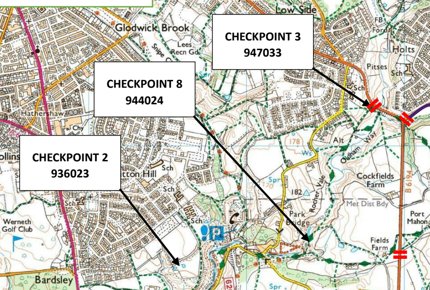
An Ordnance Survey account can then be used to produce the competitor OS maps and there are many image editors available that will allow you to draw the CP locations such as the two examples below to supply to the competitors.

No comments:
Post a Comment