Monday, 13 January 2014

The Trigger 2014


Here we go again. Another early morning alarm call on a very cold morning to get to Hayfield for "The Trigger" bus. Bit different this year as I left my car at New Mills Station and then four of us continued onto Hayfield in Geoff's car. The Cricket club is such a nice start venue, great atmosphere in side and warm as well. Chatted to quite a few people then outside to drop off the bag. Chatting to IanW outside I find out about another route change so that we will not be going down the road but instead a little cut through directly from the start field.

Happy Campers
 The early stages of this race is pretty straight forward up along the side of the reservoirs to the Isle of Sky. The Black Hill flags were in typical "Trigger Condition" varying from being perfectly OK to lethal due to the ice cover. As informed before the race we have a slightly changed route down to Crowden Brook, it did not really effect the race.  A Km after Black Hill I though my race was over when I got a bad step and aggravated (yet again) an injury in the top of my right foot that I suffered a couple of months previously when running with Pennine near South Head. Straight down on to the ground in agony. Got up after a bit and started a very dodgy hobble. I have aggravated this injury a number of times and I know that I can run it off. So I kept going as loads of people streamed past me. over the next 10 minutes. By the time I got onto the track to Crowden I was doing a reasonable impression of a run. I was running well upto the fall so despite the injury I reached Crowden in a very similar time to last year.

It is funny in Crowden hardly anybody carries straight on past the decision point for Torside or Lawrence Edge/Wild boar. The latter two seem to have become the de facto route choices. IanW rumbled me on Facebook (as he tagged me in a photo on the climb to Lawrence Edge) there is a pretty impressive picture of me with a good smile and high knee as I run up the steep climb. His comment "It's funny how the sight of a camera can make people run." as if I would do such a thing, its slanderous.

Poser!

Did not get to pose for this one!
I was up Lawrence Edge a few weeks previously and had sorted a really nice line over to Wild boar. That got scuppered when I followed the line of people in front of me and they veered over to the right to ascend onto the plateau via the heather slope to the right instead of the little scramble. That scuppered my reccie as I had identified a feature that I could get to from the top of the scramble, but from where I came up I did not know where it was! As usual everybody starts to veer south west. I got the compass out and headed directly south. I picked up a nice grough with a number of fresh tracks in it that brought me straight to the style where we leave Wild Boar Clough. That was a result! Bleaklow was hard going surprising how much snow there was so it did make for more difficult going to the Snake Path. Once again my snake path split was similar to last year (5 minute slower - last year's finish time was 4:47)
Higher Shelf Stones (credit http://runningdelights.blogspot.co.uk/2014/01/janathon-12-plus-trigger-race.html) Hard to imagine it is the same day to the photos above!

At the start some of us were chatting about the Snake to CP5 route options. My intention was to go along to Glead Hill and head south from there. Geoff had mentioned he was going to go down the east side of Within. With the likely icy flags I had decided that I would do the same as Geoff as the ice flags would not allow us to make up for the greater distance. I followed the flags for about a Km then struck south-west from there. The Strava plot is reasonable enough, fairly straight line. I have had a look at a couple of strava plots by other people with a similar time to me and I was about 5 minutes (48 minutes snake top to CP5) slower than the people that stayed on the flags. With the old checkpoint we climb up to the plateau 90 degrees to the contours, so while steep we get it done with quickly. The new checkpoint involves a long angled climb that goes on for ever and looses a lot of time.
Snake to CP5

Leaving CP5 felt like entering hell, the conditions has deteriorate considerably, with low clouds and a driving wind straight into our faces. It was to some considerable relief that I turned left down the river Kinder and some reprieve from the wind. My race went tits up at this stage. Followed the gruff system OK until forced to leave them then set my compass to join the next system. I had a guess at the bearing but it was not south enough and I did not following it properly anyway. I really started to suffer across here with yet more eye problems as they clouded over and cold hands, I needed to get some food down but it was such hard work trying to work the zip on the bum bag. I eventually hit the edge path about 50 metres north of Grindslow Knoll. Not realising this I turned left for another 50 metres until I got to a stream I recognised from the Edale Skyline and realised my mistake. About turn and headed back to Grindslow.

It's all gone 'orribly wrong!
 Around the Knoll and then followed some tracks down through the snow to the left of the footpath  with the intention of rejoining it again further down. I got to a style and I said to my self don't cross this find the proper gate that is on the foot path which was only 30 meters to my right. What did I do? I crossed it and just got further and further from the path until I had no idea where I was Fatique can you you to do silly things! Near the bottom of the hill, near Grindsbrook Clough, I was getting the map out to find out the best route to Edale when Duncan came along with another two blokes in tow. He knew where he was going so both of us bombed it back to Edale along the Tanky's finish to arrived home in 5:40. That was 50 minutes slower than last year and I reckon I lost 30 minutes of that in the last 5 Km.

Edit:
Just had a another look at the 2013 & 2014 strava plots. The split for the cairn after Kinder Gates was 4:00 in 2013 and 4:30 in 2014. So in reality I lost 20 minutes from there to the end. Not as bad as I thought!

Friday, 20 December 2013

"Peris Horseshoe" Mountain Race Snowdonia

"Peris Horseshoe" Mountain Race  Snowdonia

Category: AL
Distance: 28km / 17.5miles
Ascent: 2,600m / 8,500ft
"Peris Horseshoe" Race Details by Fell Running Routes.
Following on from Ian's great write-up of Snowdonia's Peris Horseshoe (Peris the thought), I thought I would add my tuppence worth. Part of the attraction to these long races is investigating the “sneaky routes”. Snowdonia is too far away so any investigation I could do would be by looking at maps, trolling the forums and blogs and chatting to people with “the knowledge” (Geoff a veteran with a whole one Peris Horseshoe to his name). The navigation would become more important in the second half as up to Pen Y Pas the field would still be close enough to play follow the leader. The research" proved to be mixed result with some successes and failures. The biggest failure, trying to cut the corner to the Snowdon Ranger path probably counteracted all the successes!
Peris Horseshoe Mountain Fell Race Snowdonia September Pennine Fell Runners
Less than optimum route choice!

I opted for the early start (1/2 hr before the main field, which is a great idea). The race started as it means to carry on - "brutally"! From Llanberis a 2700 ft climb through the disused quarry then continue up to Elidir Fawr. Scramble over a load of rocks then some contouring and another climb up to Foel goch. A nice descent than another climb up Y garn. Another long descent before a real slog up to Glyder Fawr. 
Peris Horseshoe Mountain Fell Race Snowdonia September Pennine Fell Runners
We gained height very quickly right from the start - looking back down to the start field.
Peris Horseshoe Mountain Fell Race Snowdonia September Pennine Fell Runners
Looking back down into the quarry we have just been through.
It is by the lake before starting this climb that the leaders started to overtake me. After that turn South-East to try and find a good line off Glyder Fawr down to Pen Y Pass. I took my time in the glorious sunshine in the first half and got to Pen Y Pass (which is the end of the Half Paris) in 2:30 where the "mars bar" man commented that I was looking very fresh.

The hardest bit was then then the run up the gradual climb of  the miners track to the turn off to Lliwedd, I could not be seen walking by the tourist so heart and lungs screaming I kept running up the slight incline! It was to some considerable relief that I cut off the main path and headed up the trail towards Y Lliwedd. I loved the “easyish” scrambling over Lliwedd and the east ridge and because of my early start I had loads of people around me. I would never have found/done the east ridge on my own as it was pretty claggy over the Lliwedd ridge and Snowdon.
Peris Horseshoe Mountain Fell Race Snowdonia September Pennine Fell Runners
Looking back at Lliwedd from the "East Ridge"
Once at the top of the East Ridge we are once again reunited with the masses. A lot of whom have gone up on the train and get in the way even more than the walkers.  Follow the train tracks down to the standing stone that marks the top of the Range path and then straight  down to the col before Moel Cynghorion. The dire warnings about the climb up (and decent from) did not materialize. I actually done too good a job of “keeping something back” so I found it was a nice steady climb up.
Peris Horseshoe Mountain Fell Race Snowdonia September Pennine Fell Runners
 About to leave the "Ranger Path" to start the last climb up Moel Cynghorion.
Peris Horseshoe Mountain Fell Race Snowdonia September Pennine Fell Runners
The summit of Moel Cynghorion is not the most exciting place in the world (but at least it is downhill from here)
Shouted out my number, over the style and then "that" decent where I got over-taken by a couple of people who gained a couple of hundred meters on me. They were off to my right and looked to have taken a better line as it looked less steep, something to lookout for next time! After the checkpoint I set my target to reel them in (more than likely pointless as I was probably half an hour behind them because of the early start!) I caught them and another woman with a dog who I did recognise because I nearly tripped over the bloody thing a number of times climbing Elidir Fawr. Crossed the railway line then join the road. As I was bombing down the hill a guy out side  the building (pub?) on the bend  having a fag shouts out the other runners went that way pointing to a gate behind the building. I could have kissed him I do not want to imagine how I would have felt if I went wrong a few hundred metres from the end of a 17 mile race. A bit of a windy track through the wood to arrive at a very low key finish line to meet a fellow Pennine Fell Runner who was hanging around to welcome us home.
I could have pushed it a bit more in the first half, with better lines and pacing I reckon I could easily have taken 15 minutes off my 5:31 time, but still pretty happy with it as I love Snowdonia and it was by far my biggest Mountain Races. The Peris Horseshoe is a fantastic race and I am at a loss to know why it is not more popular. I think sheep and lake land classics come to mind! In 2013 the Peris Horseshoe is a British Champship race so it will be considerably busier hopefully I will be there again!

Peris Horseshoe Mountain Fell Race Snowdonia September Pennine Fell Runners
Very early - climbing Elidir-Fawr Pic from "Picasawab Alastair Tye's Gallery"

Monday, 16 December 2013

The Ups and the Downs of Fell Running!

Now that road racing is behind me (for ever?) I have to seriously concentrate on "The Trigger". I had a window on Saturday morning until 09:30 to get a run in before the usually chauffeuring duties started. Six AM alarm call was followed by getting out at 06:20 to head over to Cobden Cross for a few reps. I had intended on doing six but time was against me so had to settle for five. Counting contour lines on the OS map reckons it is about 200 metres over about 1.75 Km. It is a bit of a brute of a climb as it is not constant with the  gradient at its steepest between 1 and 1.5 Km.

 I have created a Strava Segment for this climb  that puts it at 1.7 Km and (184 metres) The actual climb is a couple of minutes longer than the distance (and climb) covered by the segment. My PB for this segment is 12:38 with Marple's own Mr Iron-Man JohnE  holding the record at 10:47. When doing reps on it it tends to take about 31 minutes (17 minutes up and 14 down). I don't try very hard on the downhill! It would be considerably slower on a dark winter's morning with the soft ground and leaf cover. All my best times would be during the summer.

Got  out again on Sunday Morning at 6:15 for a 16ish Km run. I say "ish" as Strava said 18Km but it went mad 2 or 3 times and put in a few non-existent detoures. Got to see  a shooting star and a specular sunrise from "5 Ways" looking south-east towards Mount Famine. This is the best the rubbish camera on my phone could manage.


Tuesday, 10 December 2013

Stockport 10 Road Race 2013

Another year another Stockport 10. This is the 3rd year(and last time) I have done it. Perfect conditions this year, could even argue it was a bit on the  warm side (in December!) They bumped the numbers up this year allowing 1200 to enter, with 960 bothering to actually turn up on the day. I was not expecting too much this year as I have been struggling with lower abdominal muscle strain for about three months now. I have not really been enjoying my running during this time as I have a constant low level pain. This on top of changing over to forefoot running with the Inov8 bare 180s, which I am convinced are slower than my thick soled New Balance shoes. In fact I was in two minds about using the minimalist shoes because of the route change that will involve a mile on a pretty rough track which is exactly not what the bare 180s are designed for with their thin flat soles.

Race day!
 And They're Off

I turned down the volume on the phone as it is a bit embarrassing when the Strava woman starts announcing the details for the last Km. My tactics consisted of running as fast as I could from the start and try keep it up. It is a bit of a messy first few Km to this race as there are a lot of zig/zags through the park and housing estates, it was a relief to get to the Marple Rd and then down the rough track to start that great climb up from the river at Chadkirk. Being a fell runner I felt duty bound to show off a bit on this climb so I really pushed it and overtook loads of people Nearing the top of this climb I spied a lady in a Pennine top in front of me, that was a target, I caught her eventually only to be overtaken by her (and a load of other people) on the (rough) descent through the section I was concerned about. She got out of sight after that. This race finishes with a challenging climb at about 8.5 miles. I spied Holly in front of me again so yet again I tried to reel her in again to eventually finish 20 seconds ahead of her. She was telling me afterwards that she knew I was coming up behind here as my shoes have a very distinctive sound. The bare 180s have a very hard sole so they make a very loud "slapping" sound when running. I was convinced I was doing something wrong and even booked in with a forefoot (Pose running) coach. Basically my style was not too bad, not getting the right "forward lean", it is those particular shoes that are very "slappy". This photo below is just before starting the New Zeland Rd. climb, which is very late in the race. No wonder she looks tired.
I look better that that woman beside me but I do look like I am leaning back which could not be more wrong
They have a clock mounted just at the entrance to the park with is about 1/2 Km from the end. It showed that I was in and around the same time as last year, which I was delighted to see. That gave me extra motivation to push to the end to come home in 1:13:21. The EXACT same time as the 2012 race. I was very happy with this as the new route had to have been a few seconds slower due to that mile on the rough track. In fact looking at my Strava splits my three slowest kilometres are the two long climbs and then that rough section (which was downhill).
Nearly finished my 3rd Stockport 10
The 2012 and 2013 races had the same winner (Mohammed Abu Rezeq) with 14 seconds difference (2013 faster) in his two times.  Andi Jones  was 3rd in 2012 and second in 2013 despite being 17 seconds slower. Even though I had the same time I finished about 60 places lower in position 276. Have to mention the amazing effort by Pennine's AndyH. He smashed his 65 minute target with a 1:01:38.

I say it is my last year doing this and it probably will. I would not have entered this year only my wife had a deferred entry from last year that I took. I really fancy have a go at the Long Tour Of Pendle, which is only a couple of weeks before Stockport and I could not do both.

Monday, 18 November 2013

Technoloy and Fell Running - The Trigger Reccie

Two years, two Triggers, entered again for the 2014 running.  I was reasonably happy with last year's Trigger run but I knew that lots of small errors/lack of knowlege of optimum lines would have cost me time contributing to only gaining 2 of my target 10 minute reduction in the previous years time. This race is pretty much a set route from Marsden to Crowden. It is therefore the Bleaklow and Kinder Crossing that time can be gained/lost on this race. There was a bit of banter on the forum a couple of years ago between IanDarkPeak and myself following a farcical attempt to reccie from Crowden to Higher Shelf Stones. Ian commented he did not see our footsteps in the snow on the "Racing Line" to Bleaklow head. After the climb up from Crowden it is pretty rough ground over to Wild Boar Clough. In Last year's Trigger I was doing it when I saw a grough over to my left so I veered over to it to see if it made for easier going to find a nice trod that led me over to Wild Boar. I was using Strava and by exporting my Strava plot into Bing Maps I could view it on the OS 25,000 maps I was able to identify what grough it was. I have another addition to my phone with the installation of Alpine Trek and a selection of OS maps. With this I can see exactly where I am as it uses Android's satellite technology to position the map at my current position with a little pointer "you are here!".  Using this I was able to find the trod and got to Wild Boar Clough quite easy. That is all well on good but I won't be doing that on race day so I need to know the way without having to rely on the phone or map. There were lots of back and forts to identify landmarks to guide my way on race day.
I had just intended on just going to Bleaklow head and back but it was a nice morning (dispite being a bit claggy) so I pushed onto Highter Shelf Stones before attempting to retrace my steps, which is easier said than done. The meanderings on the Strava plot below are are combination of the attempts to identify landmarks and going completly wrong a couple of times on the return leg.


Wednesday, 11 September 2013

German Holiday Running and a Bob Graham assist.


With a view to having a go at a Bob Graham sometime in the future, I have offered my services for an attempt on September 20.  With this in mind I  was concious that I wanted to do some running while on holiday in Germany. I got four runs in, two of them on the road and two off road.

Climb through the vine yards.
The first run involved a savage 270 mtr climb up through the vine yards to the Niederwalddenkmal Monument. It's massive - the Germania statue at the top is over 3 mtrs high! The climb was followed by lots of meandering through the woods behind it. I was glad I had the compass as the direction I was sure was back to the statue was 180 degrees different to what the compass reckoned it was. The compass was right!


Niederwalddenkmal Monument Rüdesheim am Rhein Germany
One of the road runs was actually quite nice getting onto the small lanes east of Lake Constance in the south of Germany. It involved heading generally east through the apple orchards, getting totally lost then after a 90 minutes try to use the sun to head back west. It actually worked very well. The other road run was a bit of a non-descript out-and-back along the lake shore.

The best of the German runs was a 1100 metre climb up Rubihorn - Oberstdorf (1957mtr). It involved a very early morning start with a 2 Km bike ride to the start point I had identified the previous evening.

Lockup the bike then off.
Then a 1:45 climb (including photo stops) to reach the summit at 08:45, needless to say I met nobody on the way up. The climb passed through the spectacular Unterer Gaisalpsee - Hanging Valley at 1500 mtrs.
 
Unterer Gaisalpsee
Safety foot plates and cables!
A few sections of the climb were  alongside a fast flowing stream with some serious drops in places. The Germany had helpfully put in place steel cables to grab onto, they were much appreciated.
  There were some great photo opportunities with the clouds rolling in behind me but unfortunately  it mean that by the time I reached the summit it was covered in clouds so I missed an opportunity to get some shots of Alpine Peaks. Apparently The south of Germany is a very Catholic area, there were crosses everwhere including the mountain summits.
Summit Log at Rubihorn Summit
 
Clouds rolling in.
Back in the UK and it’s three weeks to the Bob Graham so that means two weeks of intense training then a week of cutting back. I am now 10 days into the intense period and I have done 9 runs covering 129 Km and 5000 mtrs of climbing. I have really focused on the climbing so I have done numerous reps of the Goyte to Cobden cross climb (about 220 mtrs). Fitting the training around parental duties has resulted in two 3 hr+ runs finishing after midnight.  All going well I am hoping to do three legs of the Bob Graham, I am currently scheduled to do 4 and 5 but I would like to do Leg 1 as well.
Rubihorn Summit Cross

Tuesday, 2 July 2013

DazH Memorial Race Buttermere

Loweswater Village Hall
Distance: 21.2 miles. Ascent: 9100 ft Strava Plot

At the AGM it was decided to dedicate the most improved trophy in Daz’s name. However some of us felt that this was not enough and that a race would be a true tribute to his memory. Thanks to Dan’s involvement in the idea of reintroducing the old Buttermere Horseshoe and many months of hard work by Paul et,al at  Cumberland Fell Runners the Darren Holloway Memorial Race 2013 was officially on the FRA calendar. My two main aims this year was to help out on another BG after the amazing adventure with AndyG last summer and to do one of the Lakeland Classics, which would probably be Wasdale because it’s the hardest and I want to get my money’s worth.
The ridge to Whiteless Pike
With Daz’s race confirmed Wasdale was out the window.
I was very happy with my performance on Paul’s BG attempt a couple of months ago and I knew I was in just as good shape for this one. I was guessing 6 hrs based on my 4:37 at Peris but chatting to Geoff and DaveW who were predicting 6 and 5 hrs respectively, I had to adjust my guestimate to closer to 7 hours. Reccies for this race were totally out of the question so the reccies consisted of picking up snippets of information from the race thread on the FRA forum. This proved very useful as people mentioned that different parts of the race share common ground with the Teenager with Altitude and Ennerdale. A bit of downloading of race routes from Strava and uploading to Bing maps where I can view them on the OS 25,000 maps showed me some of the more important lines namely the Haystacks and Seat bypass. Come race day I was ready with my photocopied map in its plastic sheet. Part of me was actually half hoping that it would be a bit claggy then I would have to do a bit of navigating.

On Friday night we started to arrive in the camp site in Buttermere and Pennine’s finest (Dan, Robin and myself) stood there discussing the race route. “Are we doing all these?” “Were do we start?” “Don’t know” “Do we go up that one?” “Don’t know” “Is that Haystacks?” “It looks a long way”, “I think I might be getting nervous now”. A million midge bites later Dan was getting bored and the midges were driving us mad so I was glad to head off to the Fish for a drink.
Relaxing before the start

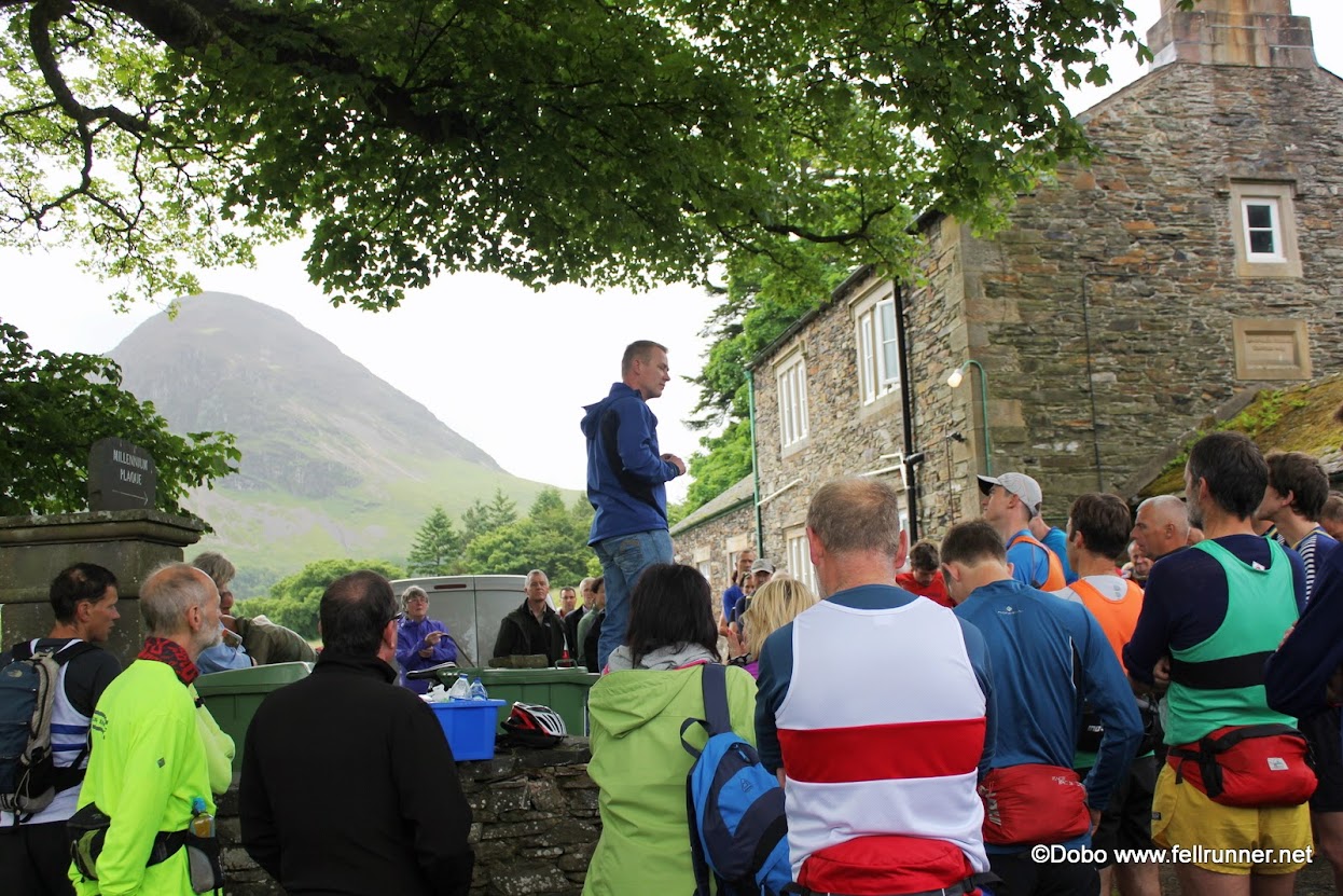
Finally race day arrived and Dan gets volunteered into being the designated driver so Robin, Hano and myself pile into his car to be ferried right up to the church hall, nothing is too good for us. The usually milling around and meeting Daz’s family.

Then a few words from Daz’s cousin (Neil) and we were off. Very quickly I was in last place while everybody went haring off down the road. I though to myself what’s the point? There were a few members of Pennine manning some gates in the early stages and I started to feel a bit embarrassed, with all of the shouts of encouragement, and me in last place so I had to do a little sprint to get into second-last place, much better.
A few words from Neil and then we were "off"

The first climb of the day was Whiteside, being 11 am the sun had yet to dry out the rocks and the cloud base was still a bit low. It all combined to make the rock on Whiteside and the crossing over to the  checkpoint at Hopegill Head pretty slippery, I believe KarenN had a bad fall in this area. There were numerous opportunities to pick safer/quicker line along this section that would have really worked to the advantage of people familiar with the route.  Following Hopegill we had the first lovely long descent of the day down to the col before below Eel Crag before starting the climb up to  Grasmoor.
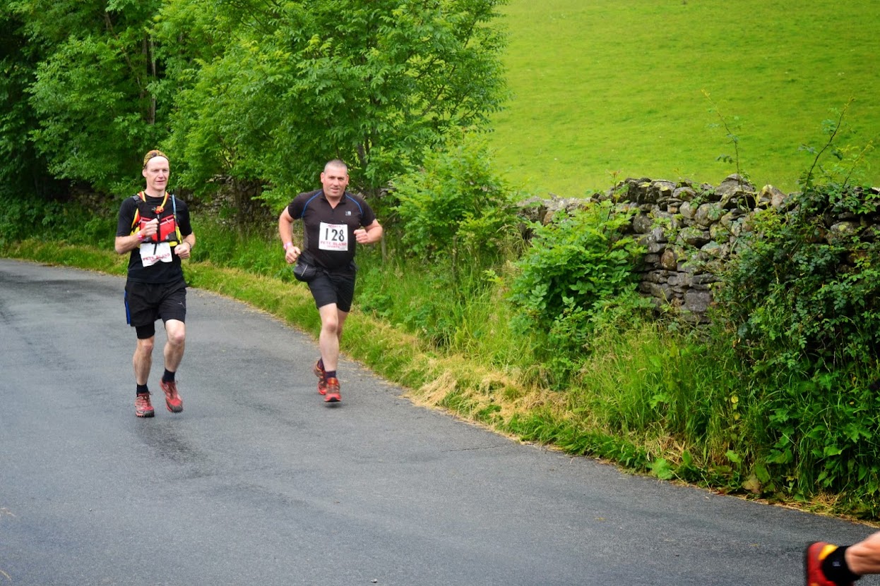
The battle for second-last place
We were setting into the race now and I was starting to identify a few people that were travelling at about my pace. This was the beginning of a long day of Leap Frog. As people overtook me I just let them go as I was confident that I would be able be able to catch them later. If it was going to be  a game of attrition, I would win   Uneventful run over Wandope Moss then a little descent on Whiteless Edge where the wet rock got me and straight down. My right hand took the blow resulting in a lovely blood flow and the thought “have I broken my wrist”. Relieved that my pelvis had escaped, I just ignored it and kept going. Get to Whileless Pike then that massive descent to Newlands. I was a bit horrified by it when driving through it on Friday eventing but it was actually quite good fun.
Nice touch Robin with the cycling cap (credit Mark Sammon)

Through Newlands and a big thank you to all of the words of encouragement before the climb up to Buttermere moss. Some words for inspiring fell runners do not try to take compass bearings off a map while walking across a bog, especially Buttermere Moss, twice in a minute I tripped over a tussock and fell flat on my face. I mucked up on this section just being lazy I blindly followed  three women (who I had being seeing a lot of during the day) in front of me. They stayed too high while contouring around Robinson and it made for very slow going, while clambering over the rocks. I over took them eventually and saw much better ground lower down. I headed down to it and made better time to Littledale Edge with the women following me.
Climbing up to Buttermere Moss from Newlands
I did not remember the descent from Dale Head to Honister being so long but there are some nice grassy bits so made for easy running.
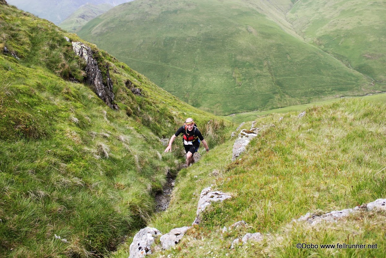
"that_fell_guy" and me reaching the top of yet another climb.


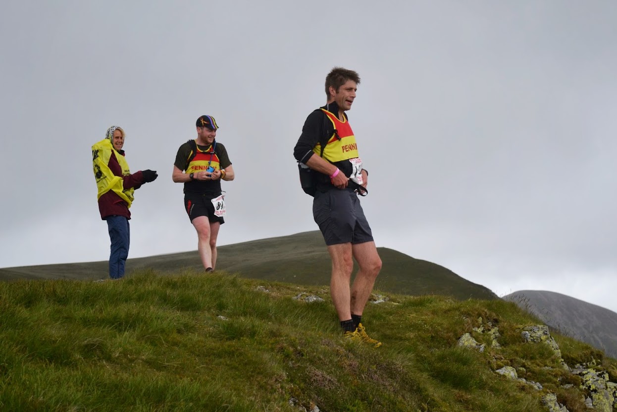
Now the climb to Inominate Tarn where I was looking forward to meeting Joe and Dan. Tricky enough area around there and I was glad to have somebody to follow to. Big hello and a fist full of Jelly Babies then my research paid off as I followed the  Ennerdale route to High Crag.  Made a mistake here as I stayed to the right of the main foot path which lead me into loose rock that slowed my progress allowing a couple to catch up with me.
By High Style the land really opens out and with the clear conditions I had not really being navigating all day so I was not totally sure of where I was without getting the map out and studying it properly. Much better to follow somebody and there were two ideal candidates a bit in front of me. I caught up with them and stuck with them around Red Pike and the descent down to Scale Beck. I don’t know what I was thinking but soon after joining the beck I thought I saw a foot path over on the other side and I assumed the two lads were intending on cutting over to it so I just broke off to have a drink in the stream and then join the footpath. When I got up to where it was, there wasn't one, it was just a little land slide. I felt a bit embarrassed to cross back again to start following the lads again so I decided to just head in a straight line to  Mellbreak. At first it was a nightmare as I was struggling through thick heather, but then I started to pick up bits of trods and the heather gave way to bracken and I was starting to realize that I had accidental made a master stroke as I could see the foot path beside Scale Beck continue downhill. Over the fence and then the long climb to Mellbreak. I noticed I was being followed by somebody in white I was curious as to where that person had come from as there was nobody close to us on the descent from High Style. After the race Hano was telling me that he and Wendy Dodds were following Scale Beck when Wendy saw me and straight away cut over to follow me. I was pretty flattered by that. The two lads I was with complemented me at the end on my line as I gained a lot of time on them. I felt like a fraud.


Dan's and Joe's checkpoint at Inominate Tarn
The end of this race is so like Peris with the steep descent and long run it. Like Peris I felt I had loads left in the tank and I was able to do a nice descent and steady run into the end. Great cheers from Stevie and Co in the pub and the shout to keep left to face that horrible little climb up the road at the end. I was always expecting to be the last Pennine home so was a bit alarmed when somebody asked where is Hano. I had not seen him all day and it was only with my bit of inspired navigation that I got past him without knowing. He arrived back in soon after me looking very tired and very happy in equal measures.

What can be said about the race it was a fantastic experience, (for my first Lake District race), amazing route in almost perfect conditions. The food was amazing, except that I had been eating sugary stuff all day so sweet cakes was the last thing I wanted, I had some anyway but I was chatting to one of Daz’s relatives telling her I was sick of sugar and would kill for a bacon sandwich, she said she would remember that for next year.

Click below for race details

Groovy Kinder Love

                  Groovy & Baby Kinder Love 05 Sept. 2026 I have added an option of running a shorter version of the Gro...